
Eddie Codel
The Lifeline of Ólafsvík Harbor
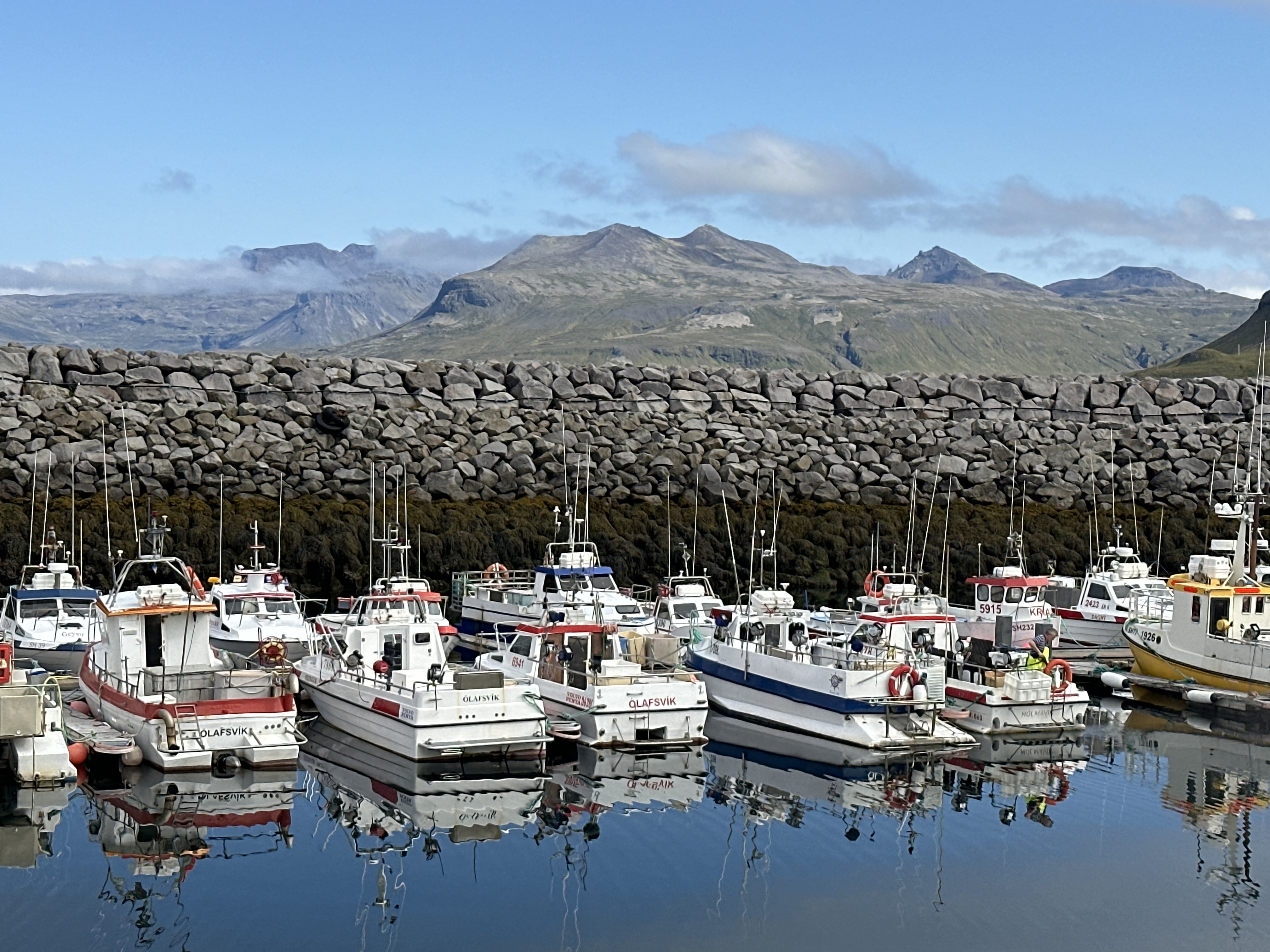
The harbor in Ólafsvík serves as a vital lifeline for one of Iceland's oldest trading ports, a town that was the first in the country to receive a commercial license from the Danish King back in 1687. What makes this particular harbor striking is the massive rock breakwater, a common but essential sight in Icelandic coastal towns. These structures are built using large, locally quarried basalt stones to protect the fleet from the ferocious North Atlantic swells that characterize the Snæfellsnes Peninsula.
Looking at the boats, you will notice the word "Ólafsvík" painted on many sterns, alongside alphanumeric codes like "SH". In the Icelandic maritime system, these letters identify the home district; "SH" stands for Snæfellsnes- og Hnappadalssýsla. The fleet here consists largely of small-to-medium-sized vessels dedicated to sustainable line-fishing. Unlike massive industrial trawlers, many of these boats use longlines or handlines to catch Atlantic cod and haddock, a method that preserves the seafloor and has supported the local economy for centuries.
The dark, textured band visible on the harbor wall just above the waterline is a thick growth of bladderwrack and other hardy seaweeds. Because of Iceland’s significant tidal range, these walls reveal a microcosm of marine life twice a day. Behind the harbor, the landscape is dominated by the volcanic peaks of the Snæfellsnes range. This area is geologically restless; the mountains are a mix of palagonite and basalt, formed by subglacial eruptions during the last ice age. The town itself sits at the foot of the Enni mountain, and because the peaks are so steep and close to the shore, Ólafsvík famously does not see direct sunlight for several weeks during the depth of winter, even when the sun is above the horizon.
The Lifeline of Ólafsvík
Ólafsvík was the first town in Iceland to receive a commercial trading license from the Danish King in 1687, cementing its role as a vital fishing hub. The small vessels in the harbor are primarily "krókaflamark" boats, which utilize longlines and handlines rather than massive industrial trawls. This method is part of Iceland's strict individual transferable quota (ITQ) system, designed to prevent overfishing and maintain the collapse-prone Atlantic cod stocks.
The dark, bulbous growth visible on the harbor wall is *Pelvetia canaliculata* (channeled wrack) and *Fucus vesiculosus* (bladderwrack). These hardy algae survive hours of exposure during the dramatic North Atlantic tidal shifts. Beyond the breakwater, the Enni mountain looms; its steep cliffs were historically notorious for fatal rockslides and "spirit" sightings, which locals traditionally attributed to hidden people (huldufólk) reacting to human encroachment on their territory.
The Lifeline of Ólafsvík Harbor
Ólafsvík harbor serves as a primary hub for the Snæfellsnes Peninsula’s commercial fishing industry. The small, high-powered vessels pictured are mostly "króka-aflamark" boats, specialized for longline and handline fishing. This method is prioritized in Iceland to maintain high-quality flesh and sustainability, avoiding the bruising common with large-scale trawling.
The harbor is protected by a massive basalt rock breakwater, essential due to the North Atlantic’s volatile swells. The dark band on the rocks indicates the intertidal zone, dominated by *Fucus* (rockweed) algae. Behind the town, the Enni mountain rises to 410 meters; its steep scree slopes and volcanic layers are classic examples of the region's basaltic strata. Ólafsvík was the first town in Iceland to receive a commercial trading license from the Danish King in 1687, cementing its role as a vital maritime outpost.